According to the White House, the Climate Services project “will provide actionable science, data, information, tools and training” to developing countries, most likely with help from NASA when needed. What those are exactly differ by region: for instance, the project could help seaside locations conjure up sea level projections and find places where houses and buildings won’t end up submerged in water. It could help other locations build infrastructure (water supply lines and deep wells are likely candidates for places prone to drought) and create population maps, among other things — anything that can help a country boost its resilience to the impacts of global warming. The initiative, which has launched with $34 million in funding, will develop services to offer Colombia, Ethiopia and Bangladesh for now. Eventually, it’ll expand its reach to the rest of the Andean region and Caribbean, East Africa and the Sahel, and South and Southeast Asia.
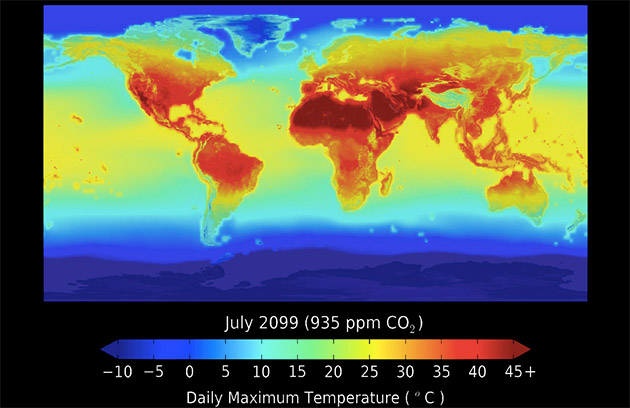
NASA’s dataset, by the way, shows how rainfall patterns and temperature will change throughout the years “in response to different scenarios of increasing carbon dioxide simulated by 21 climate models.” It was created using a big data research platform called NASA Earth Exchange within the agency’s supercomputing facility at the Ames Research Center. The full dataset is open to the public, so you can download it if the PowerPoint slides aren’t enough for you. Just make sure you have enough space on your computer, because its total size is a whopping 12 terabytes.
ref:engadget.com
